

We Tried It: Manitou Incline
Let me just preface this story with this: I am a flatlander who is afraid of heights. I’m most definitely not an adrenaline junkie. And, by this point, I have plenty of guinea pigs who could do my product testing or, in this case, experience testing for me, but sometimes you just have to do some things yourself! Am I right? But, as a marathoner who has a relative sense of fitness, I’m always looking for fun, but challenging physical activities. So, when we found ourselves with a day to spare on our trip to Breckenridge, we couldn’t pass up a chance to hike Manitou Spring’s famous Incline.

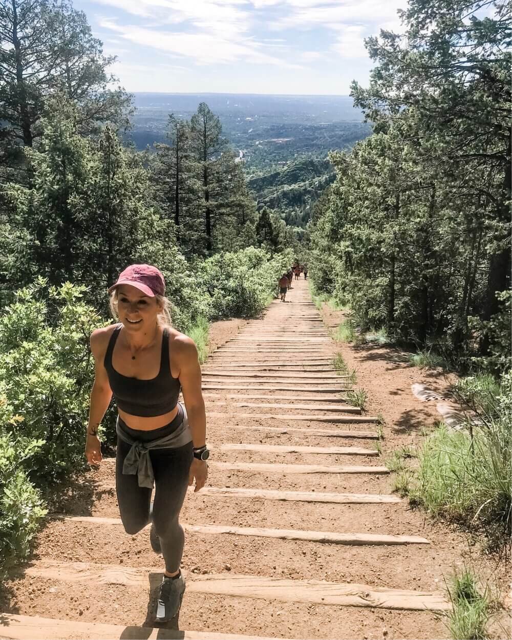
Located just west of Colorado Springs in Manitou Springs, is a devilish climb called the Manitou Incline. The Incline is a series of railroad ties (2,744 steps to be exact) that create a staircase that gains 2,000 feet in elevation over approximately 0.88 mile. This climb is definitely not for the faint of heart (or breath).
The Incline originated as a cable car railway, intended to carry materials to Pike’s Peak. In 1990, a rockslide damaged the railway and the rails were removed. Until 2013, part of the Incline was private property, and therefore, illegal to climb. Now, it’s open and free to the public.
We chose to do the Incline on a Monday morning, at approximately 8am. While the Incline is open from 6am to sunset (hours change by season), we would recommend getting an early start as the ascent is fully in the sun on a cloudless day. Visiting on a weekday has its perks as well, as you’ll find it much less crowded. And of course, make sure to carry your own water (We would recommend a Camelbak pack with a minimum of 16 oz of water).
Climbing the Incline
Of the entire climb, this first 1/3 is the gentlest. As you enter the second part of the Incline, the stairs become much steeper and the steps more narrow. For me, the middle section of the climb was the most challenging. It is in this section that the Incline reaches a grade of 68%! As I’ve said prior, I’ve got a nasty fear of heights. As it got steeper, I found that I needed to use my hand to keep my balance at certain points. In fact, looking down or behind me, caused a sense of vertigo for me that required looking squarely at my feet.
Thankfully, along the Incline there are many dirt spots that allow you to “pull off” from the main trail to take a small rest break. Having grown up far from mountains, I’m not accustomed to the higher elevation and could feel my lungs working double time to keep up.
Just when you think that you’ve reached the top, you’ve really reached the third section. The best piece of advice anyone could have ever given me was knowing that there is a false summit. Don’t be fooled by this section. At this point, you still have approximately 300 steps to go. But, fortunately, this section levels out slightly, so it’s much less steep than the middle section of the hike. However, if you’re feeling faint, there is a “bailout” point just past the false summit, that takes you over to Barr trail.
While many people run the Incline or use it as mountain training, we took it conservatively and finished the ascent in 50 minutes. (The female record is: 20:20 by Allie McLaughlin of Colorado Springs.) We (and by we, I mostly mean “I”) stopped several times to catch out breath or rest before taking the next section.
Coming Back Down
Once you reach the top, take the Barr trail, a series of 2.79 miles of single-track switchbacks. The much gentler descent provides some stellar canyon views and provides an excellent way to catch your breath.
Tips for a Successful Climb:
While not for beginners, the Incline is manageable if you create a plan and stick with it.
Take rest breaks as needed.
Carry water. (Such as a Camelbak backpack)
Don’t hike during the hottest parts of the day.
Dress in easily shed layers.
Don’t bring your pets!
Try using chlorophyll tabs for altitude sickness!
Hiked the Incline? Tell us your experience below!

Pin it for later:
